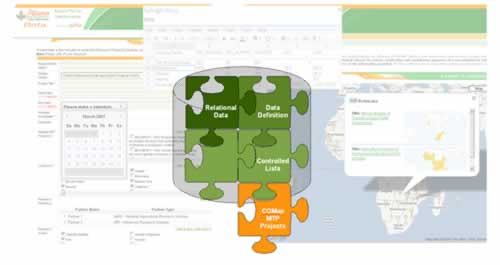
CGMap, a System-wide application that enables users to navigate easily through information on research and research-related activities that the CGIAR Centers and Challenge Programs publish in their Medium Term Plans (MTPs) every year, recently teamed up with the CGIAR’s Regional Plan for Collective Action. Their goal? To put active research projects in East and Southern Africa firmly on the map.
Read on for a rare glimpse into the workings of the CGMap application. Although this article is a little technical, we’ve tried to keep it as simple as possible, in the hope that it will guide you towards a better understanding of what goes on in CGMap’s navigation room.
Putting Research on the Map: Pushing the Envelope of Google Data APIs
Increasing the impact of agricultural research is a shared interest of the CGIAR Centers and their partners. In 2007 and 2008, the CGIAR’s Regional Plan for Collective Action surveyed and collected information from the Centers and their partners on research projects being carried out in Eastern and Southern Africa (ESA), a key geographical region for agricultural research.

In 2008, the Regional Plan for Collective Action and the ICT-KM Program joined forces to realize the next natural step for the Plan: putting active research projects in ESA on the Map.
The ICT-KM Program promotes initiatives that accelerate the CGIAR’s efforts to generate, safeguard and share knowledge in new ways. In fact, the Program’s 2008 launch of CGMap revolutionized the access to and the analysis of CGIAR Medium Term Plans (MTPs) and their related data (financial, geographic, topic) across CGIAR Centers and Challenge Programs.
Beyond Boundaries: Google Data to a Database and Records Management System
CGMap established the precedent for the contribution and diffusion of CGIAR research. At the ICT-KM Program, our challenge with ESA was to deliver a cost-effective, quick-to-market system to facilitate the contribution of the ESA research projects from 2009 and beyond, and put them on the map.
We’d already had vast experience with the Google Apps Case Study, a joint initiative with the CGIAR IT Managers, as well as Google Maps and Google Search on CGMap. As such, we were aware that the Google Data APIs provide simple, standard syndication protocols for reading and writing data/information/content.
However, the Google Data APIs, particularly the service-specific Google Spreadsheet API with Forms, do not provide relational databases. Nonetheless, after a brief study of the application’s documentation, we knew that we could make a simple and technology-neutral system with relational data for both contributing and mapping the research projects.
May 2, 2023 at 10:28 am
I found your website in google search.
The content was very important and full of information.
Thank you for sharing this content with us
فروش بلبرینگ