Towards the end of February 2009, the Google Earth Outreach grants program approved a number of Google Earth Pro licenses for the CGIAR Centers. This significant donation will facilitate the CGIAR Consortium of Spatial Information (CSI) group in communicating timely geographic information to the world.
Thanks to the initiative of Glenn Hyman (a very ‘spatial‘ CSI member from CIAT) and the coordination provided by the CGIAR’s ICT-KM Program, the 15 CGIAR Centers can now make use of Google Earth Pro. Glenn Hyman, the Geographic Information System Specialist from CIAT tells us more about how he approached the Google Earth Outreach program to get this donation for the CGIAR Centers:
In 2006, I met someone from Google at the 9th Meeting of the Global Spatial Data Infrastructure (GSDI) in Santiago, Chile. I asked her for a donation for the CSI, a request to which Google subsequently agreed. However, approval took some time because that person left Google soon after. Later, when I found out that France Lamy, an ex CIAT member of staff, was working at the Google Foundation, I wrote to her and explained about the commitment made in Santiago. She put me in touch with someone from the Google Earth Outreach program, which supports the spatial data infrastructure by helping non-profit organizations use and communicate geographic information. After providing the program with the necessary documentation, we received several one-year Google Earth Pro licenses – about three to five per Center. I would venture to say that all CGIAR GIS labs use Google Earth, and, as such, this donation will give the Centers an extra boost in capabilities
Thanks to Glenn and to the Google Earth Outreach Program for this wonderful opportunity…
More on Google Earth Pro:
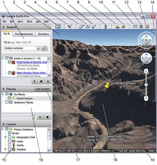
Google Earth Pro is a software tool that easily researches locations and presents the discoveries. With just a few clicks of a mouse, users can import site plans, or property lists or client sites and share the view with partners and colleagues. High-quality images can also be exported into documents or onto the web. Google Earth’s latest release includes features such as Ocean, Historical Imagery, and Touring.
Google Earth Pro features:
• Ocean, Historical Imagery, and Touring
• Faster performance
• Fly to anywhere on the planet, or explore space
• Search for schools, parks, restaurants and hotels
• Get driving directions
• Explore Featured Content
• Tilt and rotate the view in 3D
• Access Drawing tools
• Import GPS data
• Track real-time GPS
• Import spreadsheet data
• Measure area
• Movie Maker
• Import GIS data
For more information regarding the Google Earth Pro licenses in your center, please contact your centers’ CSI representatives or write to ictkm@cgiar.org
The ICT-KM Program will be communicating examples of the applications that are being developed in the CGIAR centers with Google Earth Pro soon, so stay tuned!

March 18, 2009 at 8:39 am
Excellent feature